 NERC Data Catalogue Service
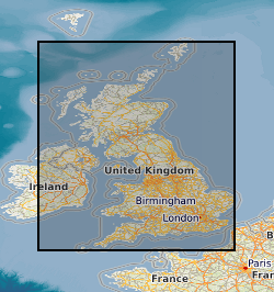
Water wells
Type of resources
Available actions
Topics
Keywords
Contact for the resource
Provided by
Years
Formats
Representation types
Update frequencies
Service types
Scale
-

Records for Great Britain of the statutory notifications of the intention to drill any boreholes, shafts or wells under the Mining Industry Act 1926 or the Water Resources Act 1991( plus voluntary notifications) . Information has been collected and maintained centrally from the 1950's, earlier records however are only on index cards. Complete for all boreholes since 1988 but record data will vary depending on the original purpose. Access restrictions apply.
-
This layer of the map based index (GeoIndex) is a map based index of the National Well Record Archive. This index shows the location of water wells along with basic information such as well name, depth and date of drilling. The index is based on the collection of over 105,000 paper records of water wells, springs and water boreholes. Geological information, construction details, water quality data and hydrogeological data may also be available for some water wells. The amount of detail held on individual sites varies widely and certain fields will have an 'unknown' value where the paper records have yet to be checked for their content. The zero values for the depth represent those for which the depth has yet to be entered into the database from the paper records.
-
This layer of the map based index (GeoIndex) shows sites where regularly monitored rest water level data are available, usually covering a long time period. The data shows seasonal fluctuations in the water table and responses to periods of high or low rainfall.
-

This layer of the Map based index (GeoIndex) shows the location of records of boreholes, shafts and wells from all forms of drilling and site investigation work. Some 850,000 records dating back over 200 years and ranging from one to several thousand metres deep. Currently some 50,000 new records are being added to the collection each year. The dataset available via the GeoIndex is a snapshot, taken at a particular date, of the Single Onshore Borehole Index. Although the GeoIndex is updated at regular intervals more information may be available than is shown.
-
The collection consists of records for c.5000 wells and springs in Scotland mostly lodged by drillers in compliance with the Water Act. These include data on well construction, water yields, water levels, water chemistry and well lithology. The collection is organised on the One-Inch Geological Sheet basis. Catalogues for wells in Central Scotland were published between 1963 and 1969. The BGS Single Onshore Borehole Index (SOBI) provides a partial digital index to the records.
-
Data from the British Geological Survey's GeoIndex Boreholes theme are made available for viewing here. GeoIndex is a website that allows users to search for information about BGS data collections covering the UK and other areas world wide. Access is free, the interface is easy to use, and it has been developed to enable users to check coverage of different types of data and find out some background information about the data. More detailed information can be obtained by further enquiry via the web site: www.bgs.ac.uk/geoindex.